Feeds:
Færslur
Athugasemdir

Posts Tagged ‘Breiðamerkursandur’

IMG_2200

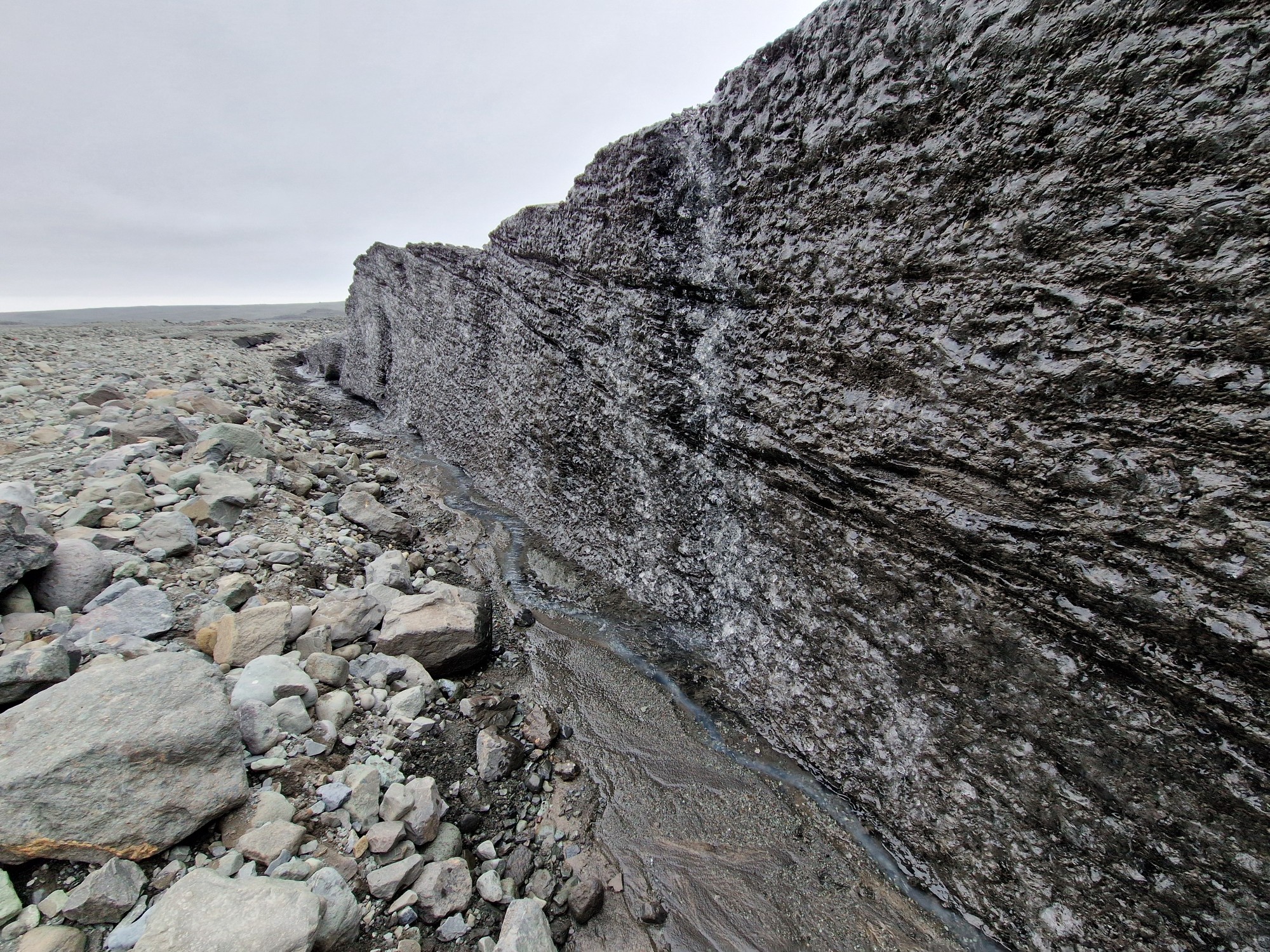
It is always striking to travel across Breiðamerkursandur and witness how the Breiðamerkurjökull glacier steadily thins year by year and retreats further inland.
Here is a recording from June 16, 2024, captured at the glacier’s terminus below Útgönguháls in Suðursveit south east Iceland. It serves as a follow-up to a recording I made at virtually the same location and published online in September 2024. Consequently, the sound of rockfalls from the slopes of Útgönguháls can be heard in this recording, just as in the previous one.
Featured here is an ice wall, approximately two to three meters high at the glacier’s terminus that is melting quite rapidly. It likely extends many meters, perhaps even tens of meters down into the ground, given that it has been barely twenty years since the glacier reached a height of up to 200 meters at this spot. High up on the slopes of Útgönguháls, glimpses of an ice mass beneath the scree slopes were visible, though that ice melted more slowly due to the insulating effect of the gravel.
The background noise in this recording comes primarily from the Veðurá river, which emerges from the glacier just a short distance from the recording site.
The soundscape at locations like this near most glacier snouts is characterized by the ceaseless flow of water, though the intensity varies throughout the year. Only on the coldest days does the flow diminish enough for the sound to fall silent or become much more subdued.

(mp3 256kbps / 56Mb)

Recorder: Sound Devices MixPre-6
Mics: Sennheiser MKH 8020/8040 (Baffled Parallel AB35)
Photo: Samsung S22

Weather: Cloudy. 2–5 m/s, 11°C
Location: 64.132776, -16.222318
Read Full Post »

IMG_2200

I was recording at Breiðamerkurjökull when the weather forecast suddenly changed. It was nothing special, except that I had to row a kayak with another one in tow with a lot of recording equipment about 8 km on Jökulsárlón glacier lagoon before the weather would hit the area.
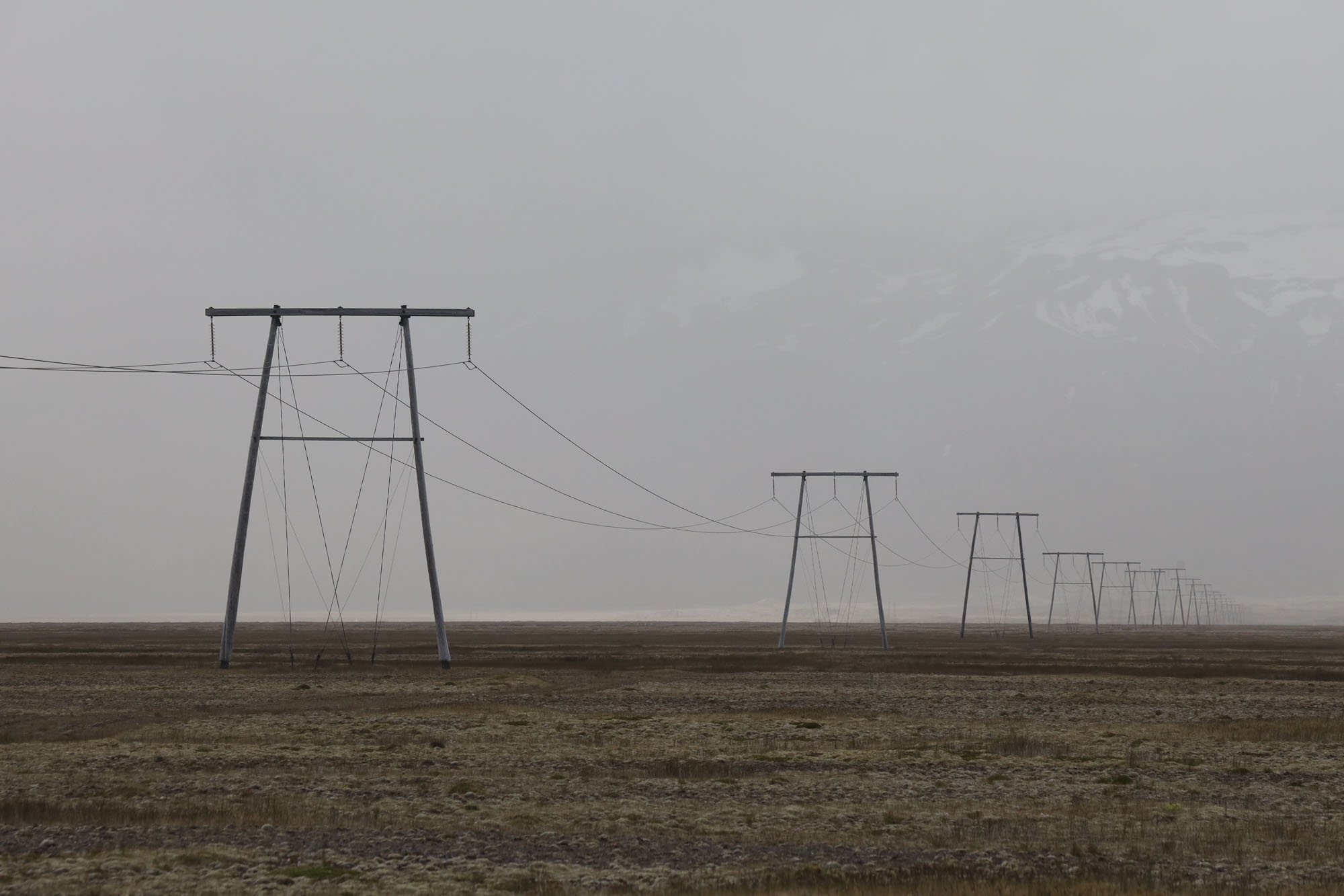
It fit, as soon as I got to land on the other side of the lagoon at midnight the fool weather arrived, so I just managed to pack all the equipment in the car and on the trailer before everything got wet. It was around two in the morning when I was able to leave. But I didn’t go far. I decided to sleep in the car near the high voltage power line (Byggðalína) on Breiðamerkursandi, south of highway no.1.
The next day it was dry, but still very windy. In fact, I could barely see Öræfjajökull glacier through a sandstorm. I decided not to be on the road with the trailer and the kayaks, but to wait until later in the day when it would calm down.
I could not sit idly by, but recorded in several places close to me. Including the high voltage line with all available equipment I had. With Omni & Cardioid microphones as well as Geophone and hydrophone which I use as a contact mic.
The result was quite amusing. By the time this happened, the strongest wind had subsided. But that moment a moisture was in the air, which caused a sizzle noise from the power line, which added a different sound and gave the recording a clearer picture of the recording location.
The recording below starts with the audible sound (microphone). Then slowly the contact mics are added . In the end and microphones faded out and you will only hear the sound from the contact mics (geophone and the hydrophone)
Because the microphone are located close to the ground in grass under the electricity pylons you will hear lot of „gray noise“ when the wind wipe the grass.
If you keep your attention Whimbrel are also audible.
So I explain the name of this blog, „Byggðalína“ is a name of high-voltage line that connects all the main settlements around Iceland. „Breiðamerkursandur“ is a name of a broad sandy wasteland south of Jökulsárlón Glacier lagoon.

  (mp3 265kps / 46Mb)

Recorder: Sound Devices MixPre6
Mics: MKH8020/8040 & LOM geophone & Aquarian H2a
Pix: Conon EOS-R

Weather: Gust up to 20m/s. Clear sky, ca. 14C°
Location: 64.028360, -16.265129

Read Full Post »