An outwash plain, also called a sandur is a plain formed of glacial sediments deposited by meltwater outwash at the terminus of a glacier. As it flows, the glacier grinds the underlying rock surface and carries the debris along. The meltwater at the snout of the glacier deposits its load of sediment over the outwash plain, with larger boulders being deposited near the terminal morraine, and smaller particles travelling further before being deposited. Sandurs are common in Iceland where geothermal activity accelerates the melting of ice flows and the deposition of sediment by meltwater.
The original sandur from which the general name is derived is Skeiðarársandur, a broad sandy wasteland along Iceland’s south-eastern coast, between the Vatnajökull icecap and the sea. Skeiðarársandur is the largest sandur in the world, covering an area of 1,300 km2 (500 sq mi). Volcanic eruptions under the icecap have given rise to many large glacial bursts (jökulhlaups in Icelandic), most recently in 1996, when the Ring Road was washed away (minor floods have also occurred since then). This road, which encircles Iceland and was completed in 1974, has since been repaired. The 1996 jökulhlaup was caused by the eruption of the Grímsvötn volcano, with peak flow estimated to be 50,000 m3/s (1,800,000 cu ft/s) compared to the normal summer peak flow of 200 to 400 m3/s (7,100–14,100 cu ft/s). Net deposition of sediment was estimated to be 12,800,000 m3 (450,000,000 cu ft).
The main braided channels of Skeiðarársandur are the Gígjukvísl and Skeiðará rivers, which incurred net gains of 29 and 24 cm (11.4 and 9.4 in) respectively during the 1996 jökulhlaup. In the Gígjukvísl there was massive sediment deposition of up to 12 m (39 ft), which occurred closest to the terminus of the glacier. The erosional patterns of Skeiðarársandur can be seen by looking at the centimeter-scale elevation differences measured with repeat-pass laser altimetry (LIDAR) flown in 1996 (pre-flood), 1997, and 2001. Of the overall deposition during the 1996 jökulhlaup, nearly half of the net gain had been eroded 4 years after the flood. These two rivers on the sandur display drastically different erosional patterns. The difference in sediment erosion can be attributed to the 2 km (1.2 mi) wide trench near the terminus where the Gígjukvísl flows, in contrast with the Skeiðará, which has braided flows directly onto the outwash plain. The Gígjukvísl river is where some of the highest level of sediment deposit occurred and also where the largest erosion happened afterward. This indicates that these massive jökulhlaup deposits may have a large geomorphic impact in the short term, but the net change on the surface relief could be minimal after a couple years to a decade. (*Wikipedia)
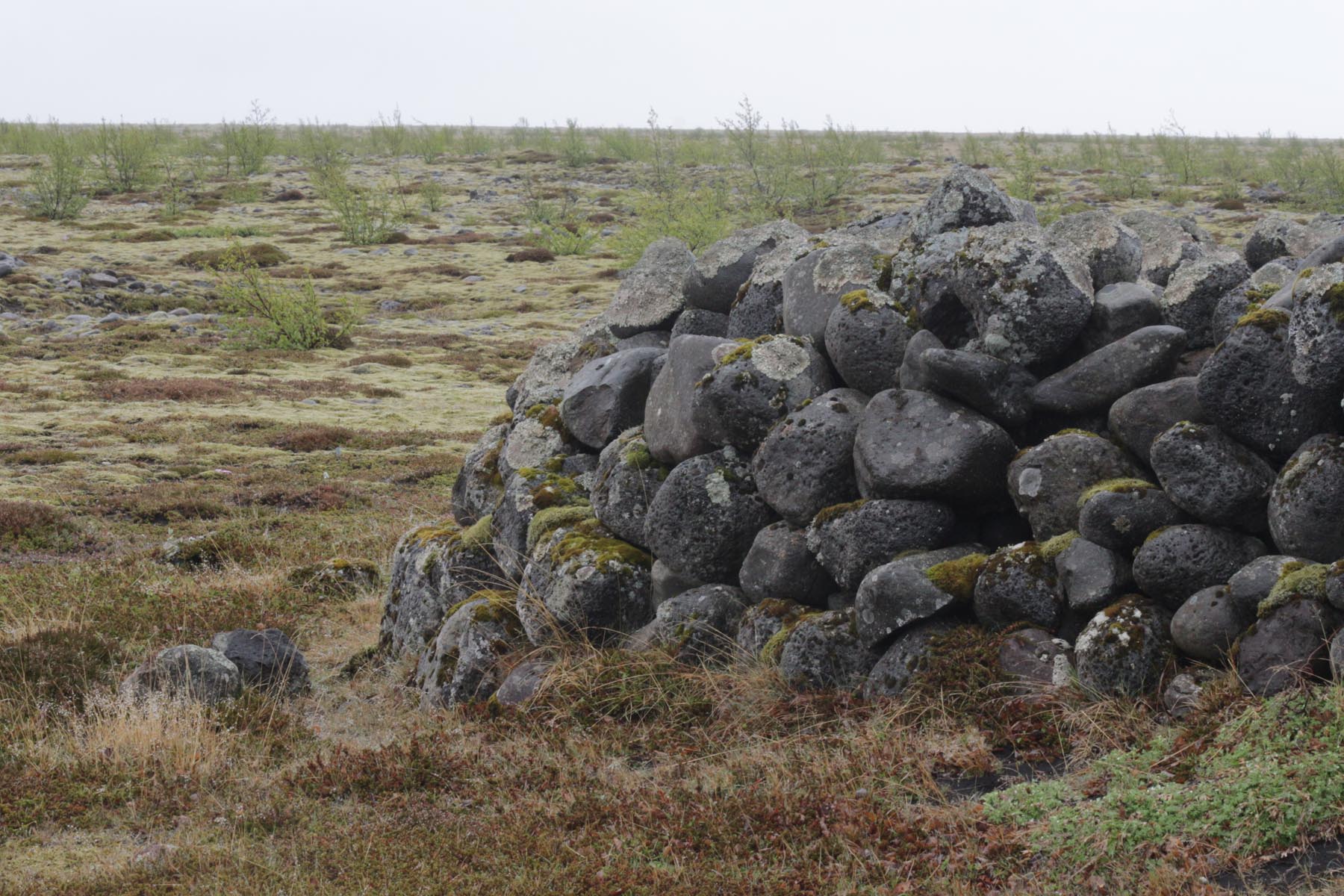
This recording is just 23 minutes of 1o hours long overnight recording. It is very quiet and highly amplified. The microphones are unexpected located near to Northern Wheatear´s nest which is between stones in old ruins in the middle of Skeiðarársandur. You can hear wing flaps and some kind of a conversation between the birds and the youngsters. The birds sounds a little bit out of phase but that could be either because the bird is mostly behind the microphones, or the stone wall, or because the fury windshield was still soaking wet after heavy rain one hour earlier.
At 1:35 min a thunderous boom sounds from glacier in distance. During the recording the weather changed from calm to be windy.
Quality open headphones are recommended while listening at low to mid level, or in speakers at low level.
Sögur af Skeiðarársandi 1. hluti
Hér er á ferðinni rúmlega 20 mínútna löng upptaka sem er partur af 10 klst langri næturupptöku frá því 29. maí 2016 á Skeiðarársandi. Á sandinum svo til miðjum er hlaðin rúst sem líklega hefur gengt því hlutverki að vera fjárrétt áður en árnar á sandinum voru brúaðar. Í upptökunni má heyra að í vegghleðsluni er hreiður Steindepils. Hann pirrar sig eitthvað á óboðnum gesti þessa nótt, hljóðnemunum, en virðist svo líka eiga einhver samskipti við unga sína með lágværu tísti eða muldri. Heyra má að á þessum rúmu 20 mínútum að veðrið breytist frá því að vera logn yfir í rok.
Mælt er með því að hlusta á upptökuna í góðum opnum heyrnartólum og á miðlungs- lágum hljóðstyrk.
(256kbps / 43Mb)
Recorder: Sound Devices 788
Mics: Sennheiser MKH20 (AB40)
Pix: Canon EOS-M
Weather & time: Clam and windy, Drissle rain, at 2AM
Location: 63.969892, -17.160032


Skildu eftir svar - Enter your comment